|
Google Earth view of my route in the Glen Canyon National Recreation Area, looking north-west. Smoky Mtn Road is dark brown, Croton Road is medium brown and Rec Road 264 out to Alstrom Point is yellow. The town of Big Water is at the west end (left side) of Smoky Mtn Road, and the Kelly Grade is as far east as I went.
|
|
 |
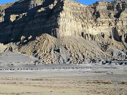
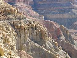
There are lots of massive rock formations to see from Smoky Mtn Road before it starts to climb out of the valley.
|
|
|
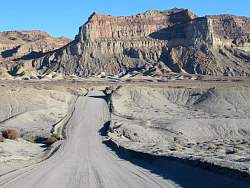 |
Smoky Mtn Road is wide and pretty smooth, at least this part is.
|
|
|
 |
On Rec Road 264 approaching Alstrom Point, you can see Lake Powell in the distance to the east.
|
|
 |
The cliffs here are almost straight down, and the go down a very long way!
|
|
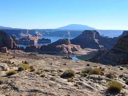 |
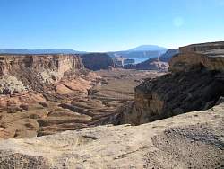
Lake Powell is far below Alstrom Point
|
|
 |
Lake Powell is far below Alstrom Point
|
|
 |
Lake Powell is far below Alstrom Point
|
|
 |
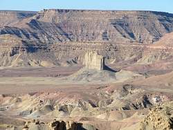
There's not much to see near Croton Road here
|
|
 |
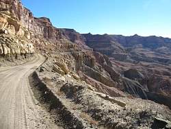
Looking back down the Kelly Grade on Smoky Mountain Road
|
|
 |
Looking west from part way up the Kelly Grade
|
|
|
 |
The road on Kelly Grade clings to the edge of the cliff
|
|
 |
If you go over the edge, you won't stop for a long time. And the roadbed doesn't look like it's built on stable rocks. This road isn't for the faint of heart here!
|
|
 |
Back down in the valley, the rocks that fall down are bigger than most cars
|
|
|