|
|
 |
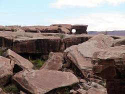
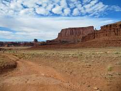
Nearby are toadstool hoodoos where the White Rim is collapsing into the Colorado River canyon
|
|
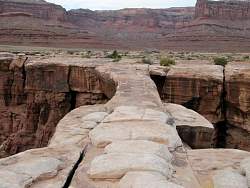 |
Looking straight down Musselman Arch
|
|
|
|
 |
I passed a 2 or 3 groups of mountain bikers that were riding the 100-mile White Rim Trail over several days. Chase vehicles carried their camping gear, food, water and etc for them. You can see a few riders in this photos at the left side.
|
|
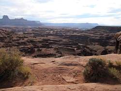 |
Eventually the White Rim will end up in the Gulf of California where the Colorado River empties into the Pacific Ocean.
|
|
|
|
|
|
|
|
|
|
|
|
|
 |
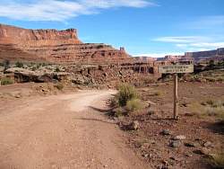
Back to Shafer Trail, instead of going straight up the switchbacks, I'm going to turn right onto Potash Road to see where it goes.
|
|
 |
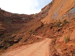
On Potash Road
|
|
|
|
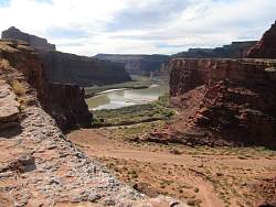 |
The road passes very close to the Colorado River, but several hundred feet above it. In the foreground is a wash, not a road.
|
|
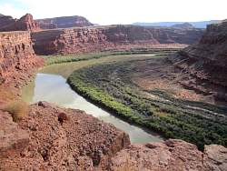 |
The Colorado River Gooseneck turn
|
|
|
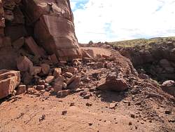 |
Hmm, this is as far as I can go today. A rock slide has blocked the road (off to the right, it drops straight down to the river several hundred feet). When I got back to the visitors center, I told the rangers about it. They hadn't heard about it before, so it must have happened shortly before I got there.
|
|
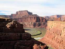 |
On the way back, I get a little different view of the river.
|
|
|
 |
Back on the Shafer Trail, about to start up the switchbacks. I will pass several mountain bikers, mostly headed uphill, on my way.
|
|
|
|