|
Trails of
Will Rogers State Historic Park,
Temescal Gateway
Park and Rustic Canyon (south-eastern
area of Topanga State Park)
|
|
|
|
|
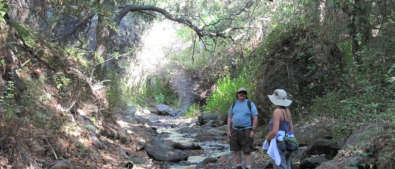
The
Rustic Canyon Trail runs along the streambed
|
Overview
This area encompasses the south-east section of Topanga
State Park. This is a very popular area, in part as you might expect being
so close to Pacific Palisades, Santa Monica and Los Angeles. And Will Rogers
State Historic Park is the original home and ranch of Will
Rogers, a popular entertainer in the early 1930's.
The area has quite a diversity of trails. There are typical
ridgeline trails, like the Temescal Ridge Trail
that connects Topanga State Park with Temescal Gateway Park. Probably my favorite
is Rustic Canyon Trail, passing through a streambed,
making it inaccessible during the wet months. Possibly the most significant
trail is Rogers Road as it forms the
east end of the Backbone Trail.
Many of the trails in this area are open only to hiking.
Official
Websites

Aerial View

View
of the south-east part of Topanga State Park, looking not quite due north. Temescal Gateway Park trails are
in yellow, Will Rogers trails are light blue, Rustic Canyon Trails are brown, Topanga State Park trails are
purple, and Sullivan trails are light green. This view is from Google
Earth
Trailheads
a. Main parking area at Will Rogers State Historic Park. There is
a fee to park here. Map
and Directions
b. Main parking area at Temescal Gateway Park.
There is a fee to park here. Map
and Directions
c. Temescal Ridge Trailhead and parking at the
top of Calle Deborah. Map
and Directions
d. Bienveneda Avenue Trailhead and street parking.
Map
and Directions
e. Sullivan Fireroad. Map and Directions
Trails
 [1] Temescal Ridge Trail
Description This very
popular trail leads from the parking area in Temescal Gateway Park north-west
to the Hub Junction in Topanga State
Park. There are a number of connections to Pacific Palisades. Being a ridgeline
trail, there are many spots with great views down into Santa Monica to the south-east
and Pacific Palisades to the south-west. The width and smoothness of the tread
varies from section to section. It starts off as a broad singletrack at the
south end. At the access spur down to Calle Deborah, it generally broadens to
fireroad width. At Trailer Canyon Fireroad, it is absolutely a fire road. The
tread is generally firm, and over the fireroad sections is pretty smooth, T1
 ; the
section between the Leacock Memorial Trail and Temescal Canyon Trail is the
steepest and probably the most rocky and rutted - T3.5
; the
section between the Leacock Memorial Trail and Temescal Canyon Trail is the
steepest and probably the most rocky and rutted - T3.5
 .
Other than these sections, it is about T2.5
.
Other than these sections, it is about T2.5
 overall.
As you climb, there is less and less shade. Below the Leacock Memorial Trail,
this trail is about a third shaded by tall chaparral. Above that, there isn't
so much shade.
overall.
As you climb, there is less and less shade. Below the Leacock Memorial Trail,
this trail is about a third shaded by tall chaparral. Above that, there isn't
so much shade.
About 2.3 miles from the bottom, there is an access spur that
leads to a parking area with restrooms on Calle Deborah. The top 100' of
this access trail is fairly steep, somewhat loose and rutted. Below that
is a concrete walkway.
Download the GPS track  to help you find your way.
Technical Rating T1
to
T3.5
;
HO
 for the southern 2.0 miles, otherwise multiuse
Trail Profile Back to
the Top

 [2] Temescal
Canyon Trail
[2] Temescal
Canyon Trail
[2a] Temescal Canyon Road
Description This extremely popular trail starts at the
parking area in Temescal Gateway Park and travels north along the steep-sided canyon
before climbing up to Temescal Ridge Trail. At the bottom, you have a choice
of taking a roadway that winds through the park facilities, or a bypass singletrack
trail to the west. A bridge crosses the stream where the trail begins to climb
to the ridge. From this bridge, you can see a small waterfall upstream and small
quiet and accessible pools of water downstream. Most of the trail is shaded,
by oak trees in the canyon and by tall chaparral higher up. The tread is firm
and generally not very rocky.
Download the GPS track
to help you find your way.
Technical Rating T2.5
HO
|
Length (miles)
|
1.6 (via the bypass singletrack) |
|
Climb (feet)
|
900 |
|
Descent (feet)
|
100 |
Trail Profile Back to
the Top

 [3] Bienveneda Trail
Description This trail climbs from the intersection
of Bienvendeda Avenue and Via Floresta in Pacific Palisades to the Temescal
Ridge Trail. A photo of the trailhead of this popular trail is to the right.
It starts off moderately steep, but becomes more of a contour trail where it
intersects with the Leacock Memorial Trail. The tread is quite firm and not
rocky. About half the trail is shaded by tall chaparral.
There is lots of parking on the street at the trailhead.
Download the GPS track
to help you find your way.
Technical Rating T2
 HO
HO
|
Length (miles)
|
0.9 |
|
Climb (feet)
|
650 |
|
Descent (feet)
|
100 |
Trail Profile Back to
the Top

[4] Leacock Memorial Trail
Description This short, quarter-mile long contour trail
connects the Bienveneda Trail to the Temescal Ridge Trail. The trail is nearly
level so there is very little climbing, and it is quite shady. The tread is
firm and not rocky.
Download the GPS track
to help you find your way.
Technical Rating T2
HO
|
Length (miles)
|
0.25 |
|
Climb (feet)
|
50 (estimated) |
|
Descent (feet)
|
50 (estimated) |
Trail Profile Back to
the Top
[5] Temescal
- Rivas Canyon Trail (AKA Temescal - Will Rogers Connector)
 Description This singletrack
trail leads from Will Rogers State Historic Park to Temescal Gateway Park. From
the east (Will Rogers) end, the trail drops into the pretty and very shaded
Rivas Canyon. This section of the trail is popular with equestrians as well
as hikers. The trail starts to climb out of the canyon through a series of tight
switchbacks. There's a sign at the bottom of the switchbacks indicating that
this section of the trail is unsafe for horses. The climb up and the descent
to Temescal Gateway Park are quite shady with tall chaparral; only the top of
the ridge has no shade.
Description This singletrack
trail leads from Will Rogers State Historic Park to Temescal Gateway Park. From
the east (Will Rogers) end, the trail drops into the pretty and very shaded
Rivas Canyon. This section of the trail is popular with equestrians as well
as hikers. The trail starts to climb out of the canyon through a series of tight
switchbacks. There's a sign at the bottom of the switchbacks indicating that
this section of the trail is unsafe for horses. The climb up and the descent
to Temescal Gateway Park are quite shady with tall chaparral; only the top of
the ridge has no shade.
The trail down to Temescal Gateway Park is a little narrower
and more rocky than the climb up from the east. As you approach the bottom,
the trail forks. The north fork (brown on the elevation profile below) is
much steeper and rocky, with a number of tall steps. This section of the trail
rates T4
 .
The south fork is like the rest of the trail.
.
The south fork is like the rest of the trail.
Overall this is a very pretty trail, and is quite popular.
Download the GPS track
to help you find your way.
Technical Rating T2
- T2.5
HO
|
Length (miles)
|
2.4 |
|
Climb (feet)
|
600 (west to east) |
|
Descent (feet)
|
500 |
Trail Profile Back to
the Top

[6] Inspiration
Point Loop Trail
 Description This fire
road loops from near the polo fields, up to Inspiration Point (photo at right),
and back. It provides access to Rogers Road, the east end of the Backbone Trail,
and the Betty Rogers Trail. Inspiration point provides a commanding view of
Santa Monica Bay in the distance.
Description This fire
road loops from near the polo fields, up to Inspiration Point (photo at right),
and back. It provides access to Rogers Road, the east end of the Backbone Trail,
and the Betty Rogers Trail. Inspiration point provides a commanding view of
Santa Monica Bay in the distance.
Download the GPS track
to help you find your way.
Technical Rating T1
|
Length (miles)
|
1.8 |
|
Climb (feet)
|
250 |
|
Descent (feet)
|
250 |
Trail Profile Back to
the Top

 [7] Betty Rogers Trail
Description This short singletrack contour trail loops
around below Inspiration Point. It connects to the Inspiration Point Loop Trail
at both ends and near the middle is a spur that leads up to Inspiration Point.
The spur is steep, rutted and somewhat loose, a real contrast to the main trail
that is firm and mostly level. This shaded, quiet trail provides a pleasant
change from the broad and busy Inspiration Point Loop fireroad.
Download the GPS track
to help you find your way.
Technical Rating T2.5
HO
|
Length (miles)
|
0.4 |
|
Climb (feet)
|
50 (estimated) |
|
Descent (feet)
|
50 (estimated) |
Back to
the Top
[8] Will Rogers Trail
Description This trail provides a shortcut up to Inspiration
Point from the parking area. Being half as long, it is correspondingly twice
as steep as the Inspiration Point Loop Trail.
Download the GPS track
to help you find your way.
Technical Rating NB

|
Length (miles)
|
0.33 |
|
Climb (feet)
|
200 |
|
Descent (feet)
|
zero |
Trail Profile Back to
the Top
[9] Rustic Canyon Trail
 Description This
is the most interesting trail in the area. Part of it goes through the creek
that flows year-round in the bottom of Rustic Canyon and part of it is steeped
in history. All of it is heavily shaded by oak and sycamore trees and very pretty.
There is a steep climb out near the north end to get to Rogers
Road. Because of the terrain, this trail is not for everyone, but if you're
a little adventurous, it won't disappoint you! To get a good idea of what's
in store, look at the Rustic
Canyon photo gallery.
Description This
is the most interesting trail in the area. Part of it goes through the creek
that flows year-round in the bottom of Rustic Canyon and part of it is steeped
in history. All of it is heavily shaded by oak and sycamore trees and very pretty.
There is a steep climb out near the north end to get to Rogers
Road. Because of the terrain, this trail is not for everyone, but if you're
a little adventurous, it won't disappoint you! To get a good idea of what's
in store, look at the Rustic
Canyon photo gallery.
This trail runs generally north, then north-west, from the east
end of the polo field in Will Rogers State Historic Park to its end as Camp
Josepho, a Boy Scout facility. There are really three sections to this trail.
Starting at the polo field, the singletrack trail of the first section heads
downhill to the bottom of Rustic Canyon. It can be a little overgrown, but the
tread is pretty firm. It follows along the back of some houses. This section
of the trail is rated T2
HO
Once at the bottom of the canyon, the trail essentially disappears.
The route from here is upstream, sometimes along the rocks at the edge of the
water, sometimes along a little trail near the stream, and sometimes hopping
along rocks in the middle of the stream. If the water isn't too high, it's not
difficult to hike this section and keep your feet dry, but some people will
find it easier just to walk through the water. Being wet and cool all year,
you will have to watch out for poison oak that grows in many places along the
trail. Here the trail is rated T5
 HO
HO
This section of the trail ends at the dam and waterfall, as
seen in the picture to the right. To get around the dam, backtrack a couple
of hundred feet or so and look for the trail to continue on an old road on
the west side of the stream. It's a little overgrown so it's easy to miss. From
here to Camp Josepho, the trail is much easier, with a firm tread, a very gentle
slope and much less poison oak. Along the way are several old buildings
and other structures, reported to be part of the compound
of a group of Nazi sympathizers during the 1930's and early 40's. This section
of the trail is rated T2
HO
There are several trails and steep staircases that lead out
of the canyon to Sullivan Ridge to the east. Not all of these have been explored
by this website.
Download the GPS track
to help you find your way.
Technical Rating T2
and T5
; HO
|
Length (miles)
|
2.6 |
|
Climb (feet)
|
400 (from Will Rogers State Historic Park
to Josepho Camp) |
|
Descent (feet)
|
200 |
Trail Profile Back to
the Top

 [10] Josepho Drop Trail
(AKA J-Drop)
[10] Josepho Drop Trail
(AKA J-Drop)
Description This At the bottom of J-Drop in Rustic Canyon,
there is a sign that states "Backbone Trail 0.4 Miles." While factually
correct, we can be thankful that the trail is actually 0.7 miles long and does
not go straight up the ridge to Rogers Road
(Backbone Trail).
J-Drop connects the Rustic Canyon Trail about 0.4 miles from
the north end at Camp Josepho to Rogers Road. The trail starts off nicely at
the bottom, but soon becomes very steep, very rutted, rocky and loose. The lower
third is quite shady from tall chaparral.
Even though this trail is closed to everyone except hikers,
mountain bikers find it makes a convenient connection between Rogers Road and
Sullivan Canyon.
Download the GPS track
to help you find your way.
Technical Rating T5
HO
|
Length (miles)
|
0.7 |
|
Climb (feet)
|
620 |
|
Descent (feet)
|
zero |
Trail Profile Back to
the Top
This page was last updated April 1, 2025