Photos of VenturaCountyTrails. Click on an image to see it full size.
We took the jeep to
 |
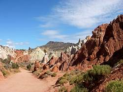
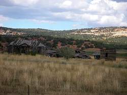
A closer look at part of the cockscomb
|
|
 |
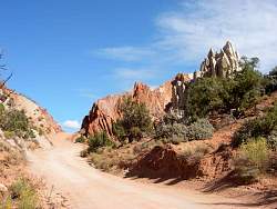
Cottonwood Canyon Road
|
|
 |
Cottonwood Canyon Road
|
|
 |
Cottonwood Canyon Road
|
|
 |
Cottonwood Canyon Road
|
|
 |
Cottonwood Canyon Road
|
|
 |
Cottonwood Canyon Road
|
|
 |
Cottonwood Canyon Road
|
|
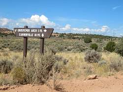 |
We took a side trip to Grosvenor Arch
|
|
 |
Grosvenor Arch
|
|
 |
Grosvenor Arch
|
|
 |
We had to keep an eye on this guy so he wouldn't steal our lunch as we were eating it!
|
|
 |
Grosvenor Arch in the background
|
|
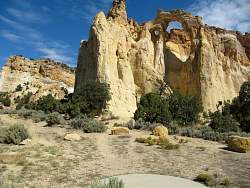 |
Grosvenor Arch
|
|
 |
Grosvenor Arch
|
|
 |
You can see Claudia partly hidden by the bushes at the bottom to get a sense of the size of the arch
|
|
 |
Cottonwood Canyon Road
|
|
 |
Cottonwood Canyon Road with the Pink Cliffs coming into view to the north-east
|
|
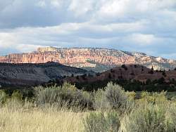 |
Cottonwood Canyon Road. More pink cliffs, maybe near Kodachrome Basin?
|
|
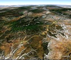 |
Google Earth view of Skutumpah Road, looking north, from near Kodachrome Basin (top right) to Johnson Canyon Road (bottom left). The little cyan squiggle a little above and to the right of center is the path of our hike in Byrce Canyon National Park a few days earlier.
|
|
 |
Skutumpah Road. There's a lot of traffic at the beginning.
|
|
 |
From the north end of Skutumpah Road, we can see the Pink Cliffs in the distance to the north-east
|
|
 |
After climbing up Skutumpah Road, we get another view of the Pink Cliffs to the north-east when we look back
|
|
 |
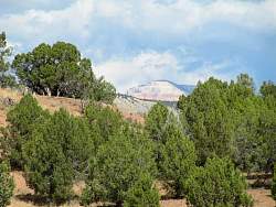
Zooming in on the Pink Cliffs
|
|
 |
Next we can see the edge of Bryce Canyon to the north-west!
|
|
 |
Bryce Canyon view from Skutumpah Road
|
|
 |
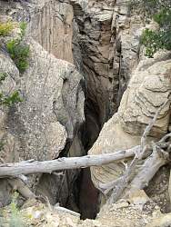
This gorge was pretty deep and is supposed to be a great hike, but you have to hike for about a mile before you can find a way down and in. We couldn't do that because we were being threatened by rain.
|
|
 |
Skutumpah Road
|
|
 |
Skutumpah Road
|
|
 |
Skutumpah Road
|
|
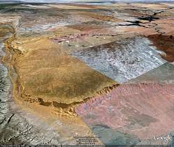 |
Google Earth view of House Rock Valley Road, looking north-west. The road skirts the west side of the Sand Hills mesa. The Vermillioin Cliffs form the south end of this mesa.That's Lake Powell in the top right corner.
|
|
 |
Driving Rte 89 one morning, we saw this smoke from a cement factory
|
|
 |
For three days running, we tried to get permits to hike to The Wave. They give out 10 permits a day, by lottery drawing. This sign shows the number of people who were trying to get permits on these days. We didn't get the permits.
|
|