 |
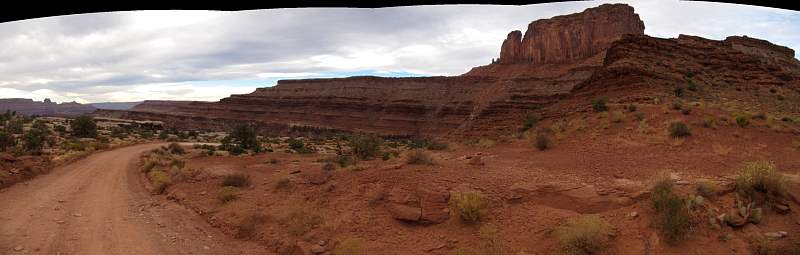
Part of Island in the Sky, Canyonlands National Park, from the White Rim Trail
|
|
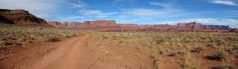 |
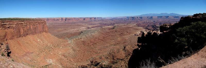
A view from the White Rim Trail in the Island in the Sky district of Canyonlands National Park
|
|
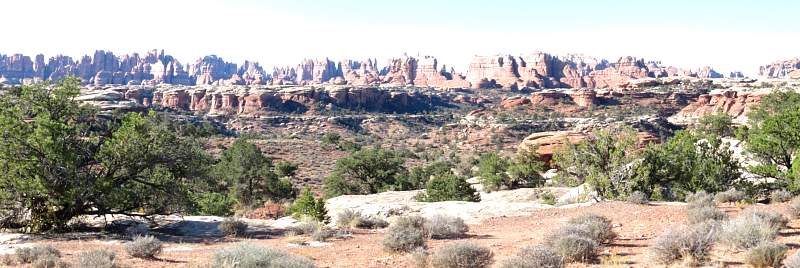 |
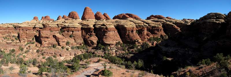
Zoomed-in view of The Needles in Canyonlands National Park from the road to Elephant Hill. Sorry about the overexposure!
|
|
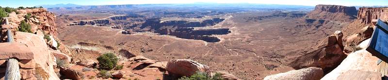 |
Grand View Point in Island of the Sky district of Canyonlands National Park
|
|
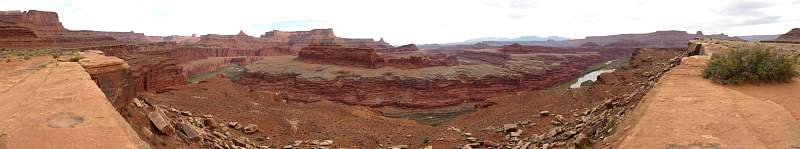 |
Gooseneck Overlook of the Colorado River in the Island in the Sky district of Canyonlands National Park. This overlook is next to the White Rim Trail.
|
|
 |
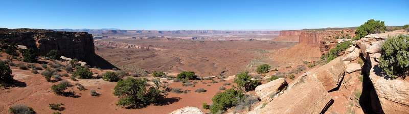
Looking west from an overlook next to the Grand View Point Road in the Island of the Sky district of Canyonlands National Park.
|
|
 |
View of The Needles in Canyonlands National Park from the road to Elephant Hill
|
|
 |
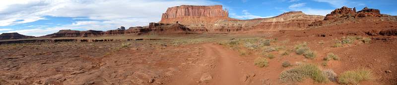
Shafer Trail in the Island in the Sky district, Canyonlands National Park. Thisi is the first view of the switchbacks headed down 1000' to the next level.
|
|
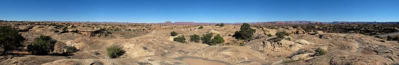 |
270-degree view from a small hill next to the Scenic Drive to the Big Spring Canyon Overlook in the Needles District of Canyonlands National Park. Just left of center is Island in the Sky, and the Needles Overlook is towards the right, both on the horizon.
|
|
 |
Another overlook at Grand View Point on the Island in the Sky, Canyonlands National Park. This overlook faces west.
|
|
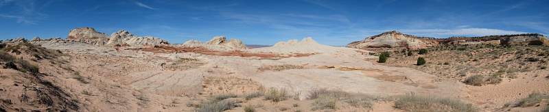 |
The White Pocket formation on Sand Hills mesa of Vermillion Cliffs National Monument in Arizona.
|
|
 |
Looking north from the top of Elephant Hill in the Needles District of Canyonlands National Park.
|
|
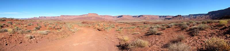 |
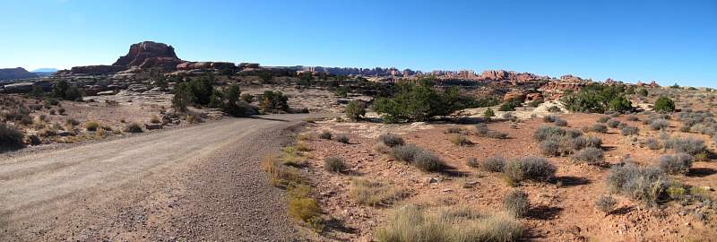
Looking north on Larkhart Basin Road, just east of the Needles District of Canyonlands National Park.
|
|
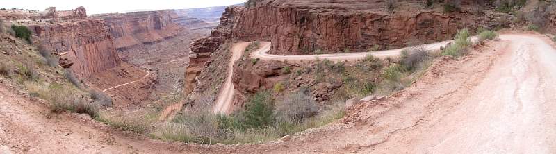 |
Looking down Shafer Trail from the top of the switchbacks, in the Island in the Sky district, Canyonlands National Park.
|
|
 |
Looking east towards Lake Powell from Rec Road 264 near Alstrom Point in the Glen Canyon National Recreation Area
|
|
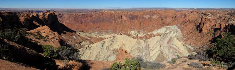 |
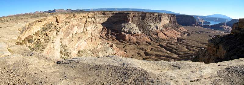
The inside of Upheaval Dome on Island in the Sky, Canyonlands National Park. The process(es) that resulted in this feature are controversial and uncertain.
|
|
 |
Part of Island in the Sky, Canyonlands National Park, as seen from the White Rim Trail
|
|
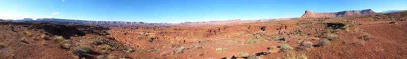 |
270-degree view from near Lockhart Basin Road, just east of the Needles District of Canyonlands National Park. At the far left, on the horizon, is Island in the Sky, and on the far right is the Needles Overlook.
|
|
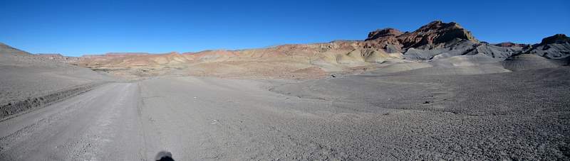 |
Croton Road in the Glen Canyon National Recreation Area
|
|
 |
Looking east from the White Rim Overlook at the Gooseberry Trailhead on Island in the Sky, Canyonlands National Park.
|
|