![]()
![]()
![]()
![]()
|
|
|
|
|
|
Trails of |
|||
|
Wildwood and Lynnmere Open
Space area Trails |
|||
|
|
||
|
|||
This web page is under construction. Please check back in a few days, weeks or months to see if it's ready. Thanks!
For now, use the old, old map of Wildwood Park.
|
|
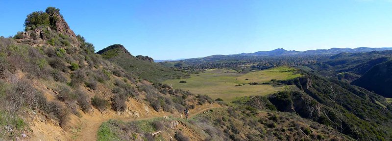
View
of the
This view is from Google
Earth
Trailheads, Parking and Features
a. Main parking are at the west end of Avenida De Los Arboles. Map
and directions
b. Secondary parking area at the bottom of the Public Access
Road
c. Santa Rosa Valley County Park. There is a fee to park here. Map and
directions
d. Wildflower Park and Ballfields. Map and directions
e. Wildwood
Neighborhood Park and Wildwood Elementary School. Map and directions
f. 76-Step
Trail trailhead on Velarde Drive. Map and directions
g. Moonridge Trail trailhead
on Majorca Court. Map and directions
h. San Miguel Trail trailhead on San
Miguel Circle. Map and directions
i. Gold Canyon Trail trailhead on Velarde
Drive. Map and directions
j. Shenandoah Trail trailhead on Shenandoah Street.
Map and directions
k. Las Flores Trail trailhead on Avenida De Las Flores.
Map and directions
l. Las Flores Trail trailhead on Avenida De Las Flores.
Map and directions
m. Lynnmere Trail trailhead on Lynn Road. There is no
parking here.
aa. Thistle Trail trailhead where it crosses Lynnmere Drive.
There is no parking here.
bb. Lynnmere Trail trailhead at the top of Camino
Magenta. Map and directions
cc. Lynnmere Trail trailhead where it crosses
Calle Yucca. Map and directions
dd. Box Canyon Trail trailhead at the southwest
end of Rocky High Road. This is a private road in a gated community.
q. Hill Canyon Water Treatment Plant
r. Skunk Hollow picnic area
s.
Wildwood Canyon picnic area
t. Oak Grove picnic area
u. Sycamore Flats
picnic area
v. Meadows Cave and Amphitheater
w. Indian Cave
x. Teepee
y.
Paradise Falls picnic area
z. Lizard Rock
Description This
Download the GPS track ![]() to help you find your way.
to help you find your way.
Technical Rating
|
Length (miles) |
|
|
Climb (feet) |
|
|
Descent (feet) |
Trail Profile Back to the Top
This page was last updated June 22, 2011
|
|
Thanks for looking at Steve's guide to trails in Ventura County, the Santa Monica Mountains National Recreation Area (SMMNRA) and other locations. |
|